Facebook
 X
X
 Pinterest
 Copy Link
Quick Answer
Brea fire hazard zones require 200 feet of defensible space around a structure. That applies in both the High and the Very High tier, double the 100-foot state baseline. The zone also drives sprinkler, roof, and access-road standards, plus seller disclosures. It does not set the price of home insurance, because carriers rate wildfire with their own models.
Brea fire hazard zone and insurance details verified as of July 27, 2026. Sources include the Brea City Code, CAL FIRE, and the California Department of Insurance. Analysis by Michael Mellgren, REALTOR® (DRE #02321556).
What are the Brea fire hazard zones, and where are they?
A fire hazard severity zone rates how readily land could burn. It is not a forecast that it will. CAL FIRE builds each rating from vegetation, terrain, fire weather, and wind. The result sorts land into Moderate, High, and Very High tiers.
That statewide rollout finished on March 24, 2025. Brea then put the maps in front of residents. Its fire department published them and took public input from April 1 to April 30, 2025.
The city has since adopted them. In its 2025 General Plan Annual Report, Brea states that it adopted the updated fire hazard severity zone maps. It also adopted the 2025 California Wildland-Urban Interface Code, with local amendments that tighten brush clearance.
Geography concentrates the hazard at the city’s eastern end. Carbon Canyon carries most of Brea’s wildland-urban interface. The city puts the canyon at roughly 1,758 acres. Carbon Canyon Road bisects it and serves El Rodeo, Olinda Village, Hollydale Park, and La Vita Hot Springs.
Still, the Brea fire hazard zones are not the whole map. Brea City Code section 16.04.040 defines a wildland-urban interface area more broadly. It reaches any area the fire code official flags for nearby combustible vegetation. A parcel can therefore pick up interface duties without a Very High rating.
How do you find out if a Brea home is in a fire hazard zone?
Check the parcel, never the neighborhood. Zone lines follow terrain and fuel rather than tract boundaries. Two homes on one street can therefore carry different ratings. The Office of the State Fire Marshal runs a statewide viewer that takes a street address.
Brea’s fire department also maintains the city’s own maps. During a sale, the answer arrives in writing. Nearly every California resale includes a natural hazard disclosure report, which names the zone for the exact parcel.
That report beats a neighbor’s recollection or an old listing remark. It is drawn for one address, not for a tract. Read it before the contingency period closes.
What do the Brea fire hazard zones require that state law does not?
Brea layers real local amendments on the state code, and several exceed the statewide floor by a wide margin. On September 16, 2025, the City Council adopted Ordinance 1265. That ordinance repealed the old fire chapter.
In its place, the city adopted the 2025 California Fire Code and the 2025 California Wildland-Urban Interface Code. The table below sets the state minimum beside what Brea’s adopted code requires.
| Requirement | California minimum | Brea’s adopted fire code | Source |
|---|---|---|---|
| Defensible space | 100 feet around a structure, and not past the property line | 200 feet from a structure, in both the High and the Very High zone | Public Resources Code §4291; Government Code §51182; Brea City Code §16.04.100 |
| Fire sprinklers | Required in new one- and two-family homes statewide, with no retrofit trigger for an addition | Required in all new structures in the High and Very High zones. For an existing home in a Very High zone, an addition of 33% or more (or over 1,000 square feet within two years) triggers a full system, against 50% elsewhere in the city | Brea City Code §16.04.080 |
| Roof replacement | Class A roof covering on new construction in a wildland-urban interface area | Replacing 33.34% or more of an existing roof within 24 months triggers the new-construction roof standard, and any patch must meet at least Class A | Brea City Code §16.04.100 |
| Fire apparatus access | 20 feet of unobstructed road width | 24 feet inside a fire hazard severity zone, plus two separate public access and exit roads for developments in a zone | Brea City Code §16.04.070 |
| Roadside brush clearance | Left to the local fire code official | 75 feet or more on each side of highways, roads, and private streets, measured from the flow-line or improved edge | Brea City Code §16.04.050 |
| Fuel modification upkeep by an association | No statewide requirement | Recorded conditions, covenants, and restrictions must budget specific funds for upkeep, and the zone gets an annual Brea Fire Department inspection | Brea City Code §16.04.100 |
Brea local fire code requirements against the California minimum, verified July 2026. Sources: Brea City Code Chapter 16.04 (Ord. 1265, 9/16/2025), California Public Resources Code §4291, and California Government Code §51182; summary by Michael Mellgren, REALTOR®.
Defensible space runs 200 feet in Brea
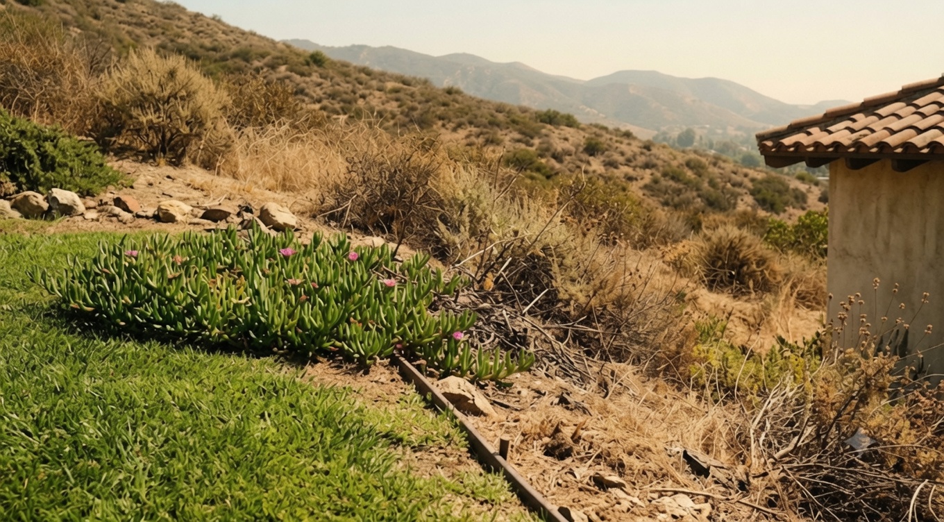
Defensible space is the treated ground around a structure. Dead brush is cleared, limbs are trimmed, and fuels are thinned. State law sets the standard at 100 feet. Brea’s adopted code lists 200 feet, in both the High and the Very High zone.
That local figure is the one an owner is held to. Lot size still caps the obligation in practice. State law does not push clearance past the property line. An owner on a half-acre lot simply treats the whole lot.
On the larger canyon parcels, though, 200 feet is a real annual chore. It is not a paperwork item. Budget the labor before closing rather than after.
Sprinklers, roofs, and access roads
Three other Brea rules can reach a homeowner without warning. First, an existing home in a Very High zone triggers a full sprinkler system at a 33% addition. Elsewhere in the city, the bar sits at 50%.
Second, re-roofing more than a third of the roof within 24 months pulls the job up to the new-construction standard. Third, developments inside a zone need two separate public access and exit roads. That last rule is why canyon subdivisions look the way they do.
Fuel modification zones and homeowner associations
Brea also puts the fuel modification burden in writing before anyone moves in. Where an association maintains a fuel modification zone, the recorded covenants must budget specific funds for the work. Its fire department then inspects the zone once a year.
For a buyer, that changes what matters in the disclosure packet. An association’s reserve study and inspection history are worth reading closely. Skimming them is how a surprise assessment arrives later.
Do the Brea fire hazard zones raise home insurance costs?
Not directly, and the state says so plainly. The California Department of Insurance tells consumers that the CAL FIRE maps do not affect rates or availability. Insurers already price wildfire with their own catastrophe models. Those models weigh slope, fuel, access, and the house itself rather than a zone label.
The Brea fire hazard zones also sit outside the state’s formal trouble list, which cuts both ways. On the Department’s March 6, 2025 designation, Orange County is not a distressed county. No Brea ZIP code appears among the undermarketed ZIP codes either.
So the availability rules below are not aimed at Brea. Carrier appetite in a canyon still varies from one company to the next. Shop the quote rather than assume it.
What changed in California’s insurance market for 2026?
A new trade explains much of what a hillside owner is seeing. Under the Department’s Sustainable Insurance Strategy, an insurer may now use forward-looking catastrophe models in a rate filing. It may also include California net reinsurance costs. In exchange, it must commit to covering at least 85% of properties in the state’s distressed areas.
Fresh numbers show where that stands. California counts 662 ZIP codes in distressed areas. The FAIR Plan held 668,609 homeowner and commercial policies as of December. Six homeowners insurance groups are expanding here under the strategy, against none the prior year.
Those figures come from the Department’s own snapshot, updated in February 2026. Average premiums run $1,571 in California and $1,512 nationally. None of that guarantees a quote at any given address.
Treat the policy as a real line item, not an afterthought. Price it before removing a contingency. For eligibility and coverage at one property, talk with a licensed insurance agent or broker.
Did the Carbon Fire lock in insurance protections for Brea?
No, and the reason is worth understanding. The Carbon Fire started at Carbon Canyon Road and Olinda Road on April 25, 2026. It burned roughly 205 acres and reached full containment on April 30.
Evacuation warnings covered Olinda Village, Hollydale, El Rodeo Stables, and Brea Hills. The Orange County Fire Authority worked the fire in unified command with the Brea Fire Department and CAL FIRE.
Even so, the one-year moratorium is not automatic. Insurance Code section 675.1 blocks cancellation and non-renewal for wildfire risk only after the Governor declares a state of emergency. The Department then publishes a bulletin naming the covered ZIP codes.
No such bulletin followed the Carbon Fire. As of July 2026, the Department’s published list of declarations runs through December 23, 2025. It carries no entry for the Carbon Fire.
Orange County’s last appearance on that list came from the September 11, 2024 Airport Fire declaration. Its one-year window has since closed. A Brea owner near the canyon therefore has no active section 675.1 shield. Check the Department’s live ZIP code lookup rather than assume.
What must a Brea seller disclose in a High or Very High zone?
Two duties attach at the point of sale inside the Brea fire hazard zones. Under Civil Code section 1102.19, a seller in a High or Very High zone must document defensible space compliance. If that paperwork is not ready before closing, the parties may agree in writing that the buyer will comply within one year.
Here Brea’s local standard matters. The statute reaches local vegetation management ordinances, not only the state figure. Compliance for a Brea parcel is measured against the city’s 200-foot requirement. A seller who cleared to 100 feet and stopped may fall short of what a lender or insurer expects.
Second comes the fire hardening disclosure under Civil Code section 1102.6f. It applies to homes built before January 1, 2010. Sellers list features that could admit embers, such as gaps in eaves or a wood shake roof. They also state which hardening improvements exist.
Since July 1, 2025, that notice must carry the State Fire Marshal’s low-cost retrofit list. It must flag which items are done. These are disclosure duties rather than retrofit mandates, so nothing forces a seller to rebuild before listing.
Brea fire hazard zones and insurance: common questions
Is defensible space in Brea 100 feet or 200 feet?
Brea’s adopted code lists 200 feet of defensible space from a structure. That applies in both the High and the Very High zone, and the local requirement governs inside the city. The 100-foot figure is the statewide baseline under Public Resources Code section 4291 and Government Code section 51182. State law lets a local agency require more, and Brea has.
How much notice must an insurer give before non-renewing a Brea policy?
California Insurance Code section 678 requires at least 75 days of notice. A residential property insurer must deliver either a renewal offer or a notice of non-renewal in that window. Use the time the day the notice arrives, not the week before expiration. For alternatives at a specific address, consult a licensed insurance agent or broker.
Are fireworks allowed in Brea?
No. The Brea Fire Code bars the sale, use, and display of 1.4G fireworks, commonly sold as Safe and Sane. It also bars the storage, sale, possession, and handling of 1.3G fireworks. One exception applies citywide: a permitted public display fired electrically by a licensed pyrotechnic operator.
Which agency responds to a wildfire in Brea?
Brea Fire Department serves the city as its own municipal department. It runs roughly 54 personnel across four stations, covering about 12.43 square miles. Mutual aid fills the gaps on a larger incident. The Carbon Fire began on unincorporated land, so the Orange County Fire Authority held jurisdiction there.
Carrying cost drives most of these decisions. Read these Brea details beside the parallel rules for Anaheim Hills fire hazard zones and for wildfire hazard zones and home insurance in Yorba Linda. The separate question of the best time to sell a Brea home sits alongside them.
Weighing a Brea hillside home?
Zone, clearance record, disclosure packet, and insurance quote together decide what a canyon home costs to own. Michael Mellgren, REALTOR®, follows how Brea’s local fire code and California’s insurance rules land on North Orange County property. He can confirm which zone a Brea address falls in, and lay out what the sale paperwork will ask for.
Email Michael Mellgren about a Brea fire hazard zone, or call or text (714) 420-6629. For premiums, coverage, and eligibility, consult a licensed insurance agent. For parcel-specific clearance and permit requirements, contact the Brea Fire Department.
This post is general information about fire hazard severity zones and property insurance in Brea and California, current as of the date shown. It is not legal, tax, financial, or insurance advice, and it creates no attorney-client or agent-client relationship. Rules change, and they apply differently to each lot. Confirm the details for an address with the City of Brea and a qualified professional.