Facebook
 X
X
 Pinterest
 Copy Link
Quick Answer
Yorba Linda’s high-density rezoning puts the tallest, densest housing in the Savi Ranch area, in the city’s southeast corner. There, zoning now allows up to 60 units per acre and five stories. The plan spreads the rest across 18 named sites citywide. Together they cover less than 2% of the city’s land. The city rezones for capacity, but it does not build the homes.
Rezoning and Housing Element details verified as of July 10, 2026. Sources include the City of Yorba Linda, the Orange County Registrar of Voters, and the California Department of Housing and Community Development. Analysis by Michael Mellgren, REALTOR® (DRE #02321556).
Why does Yorba Linda have to rezone for high-density housing?
The rezoning exists because state law requires it. Under California’s Regional Housing Needs Assessment, or RHNA, the state assigns each city a housing target. Yorba Linda’s target is 2,415 new homes for the 2021 to 2029 cycle. The Southern California Association of Governments passed that number down to the city.
The city does not build any of these homes. Its only duty is to zone for that capacity. Whether owners and developers pursue it is up to them. So the market, not the city, decides what actually gets built.
A city that fails to adopt a compliant plan faces real risks. Those include the loss of local land-use control and state fines. A non-compliant city can also face the Builder’s Remedy. That state rule lets certain high-density projects skip local zoning. To keep control, Yorba Linda adopted a Housing Element and the rezoning that carries it out.
Where is Yorba Linda placing the high-density rezoning units?
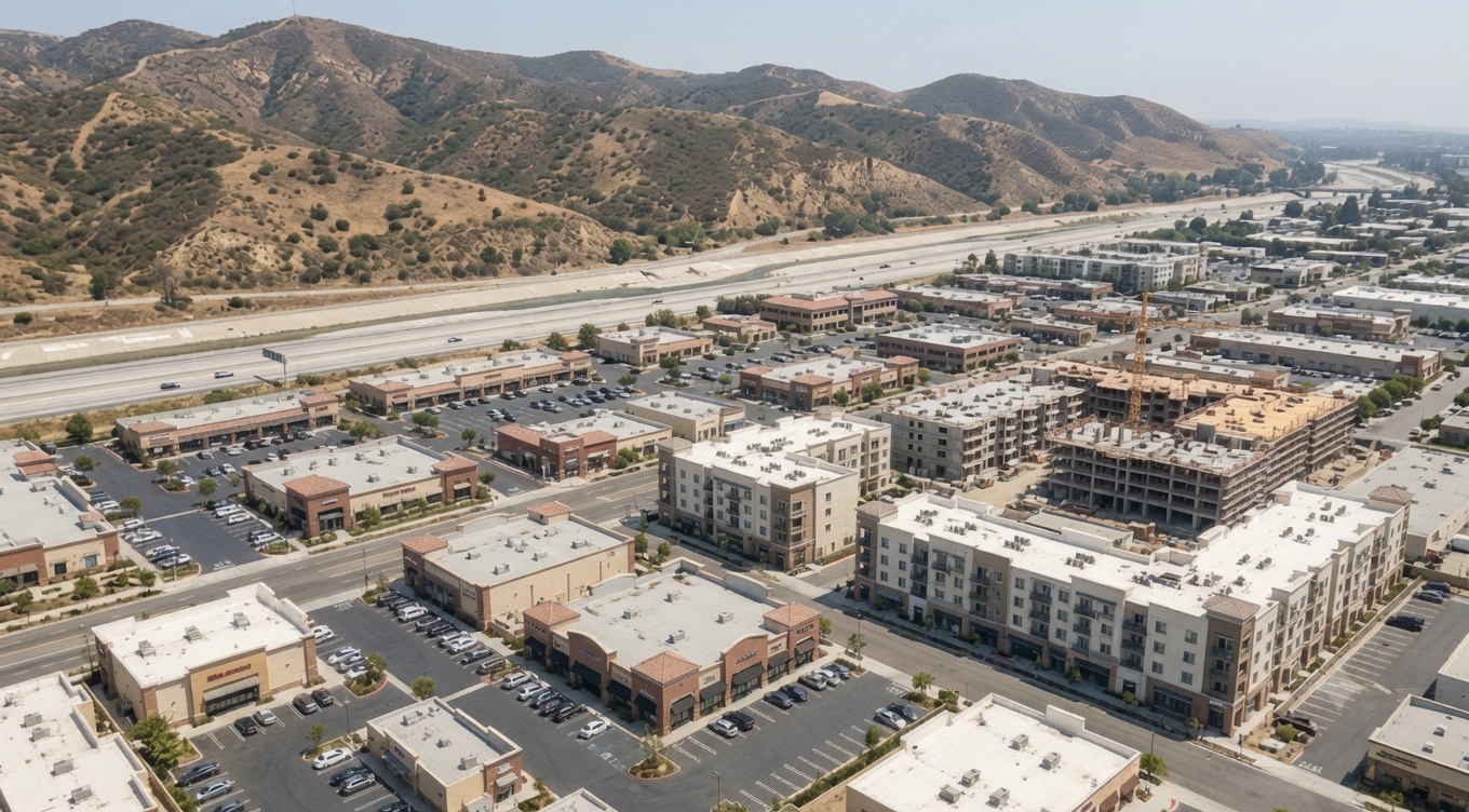
The densest housing is planned for the Savi Ranch area, in the southeast corner of Yorba Linda. The area sits between the 91 Freeway and the Santa Ana River. Three sites there may reach 60 units per acre and five stories. They run along Old Canal Road, Oak Crest Circle, and near Eastpark Drive and Savi Ranch Parkway. That is the tallest, densest zoning in the plan.
Savi Ranch is an existing retail, office, and commercial district rather than a residential neighborhood. The city’s stated goal is a mixed-use, downtown-style area that pairs housing with shops and restaurants. The area already holds the Oakcrest Terrace and Oakcrest Heights apartments, built between 2016 and 2017.
Beyond Savi Ranch, the plan spreads capacity across smaller sites citywide. These sit along corridors such as Imperial Highway, Bastanchury Road, Richfield Road, and Yorba Linda Boulevard. A few are individual parcels near Rose Drive, Eureka Avenue, and Plumosa Drive. Several carry overlay zones, such as an Affordable Housing Overlay or a Mixed-Use Overlay. Where those apply, density can reach 35 units per acre.
| Area or corridor (site references) | Maximum density | Maximum building height |
|---|---|---|
| Savi Ranch: Old Canal Road, Oak Crest Circle, Eastpark Drive and Savi Ranch Parkway (S6-015, S6-020, S6-025) | 60 units per acre | 85 feet (up to 100 feet by permit), or 5 stories |
| Vacant parcel west of 16951 Imperial Highway (S1-021) | 35 units per acre | 50 feet, or 4 stories |
| Overlay sites near Rose Drive, Eureka Avenue, Plumosa Drive, Bastanchury Road, Richfield Road, Liverpool Street, and Mountain View Avenue (S1-200, S3-082, S4-075, S2-008, S3-012, S2-013, S3-024, S3-210) | 35 units per acre | 40 feet, or 3 stories |
| Altrudy Lane and Yorba Linda Boulevard (S4-200, S4-204B) | 20 units per acre | 40 feet, or 3 stories |
| Imperial Highway and Richfield Road (S3-211, S3-207) | 10 units per acre | 35 feet, or 2 stories |
| Bastanchury Road and vacant land near Fairmont Boulevard and Quarter Horse Drive (S3-203, S5-008) | 3 to 5 units per acre | 35 feet, or 2 stories |
Approved maximum residential density by location under Yorba Linda’s Measure JJ high-density rezoning, verified July 2026. Sources: City of Yorba Linda Ordinances 2024-1109 and 2024-1111 and the Orange County Registrar of Voters Measure JJ impartial analysis; summary by Michael Mellgren, REALTOR®.
Density here means the maximum number of homes allowed on each acre of land. In several areas, Measure JJ actually lowered the planned density rather than raising it. Those areas include the Richfield and Christmas Tree Farm area, Buena Vista, and vacant land near Fairmont Boulevard and Quarter Horse Drive. Each is now held to between 3 and 10 units per acre and two stories.
What did Yorba Linda voters approve with Measure JJ?
Yorba Linda residents approved the rezoning directly through Measure JJ. It passed with more than 90% support in November 2024. The Orange County Registrar of Voters certified the result on December 3, 2024. The measure carried the formal title of the Local Control, Residential Neighborhood, Open Space Protection Measure.
That vote was required by Yorba Linda’s own Right-to-Vote Amendment, known as Measure B and passed in 2006. It forces a citywide election before the city can make major changes to its land-use plans. Rezoning for the Housing Element counts as a major change. So residents had to approve it directly. The full program is documented on the City of Yorba Linda’s Housing Element program.
This was actually the city’s second attempt. A first version, Measure Z, failed in November 2022. The city then rebuilt the plan with a resident working group and seven public workshops. Measure JJ followed. Two ordinances, numbers 2024-1109 and 2024-1111, put the approved changes into effect.
Does rezoning mean high-density homes will actually be built in Yorba Linda?
No. Rezoning changes what a property owner is allowed to build, not what must be built. The measure’s own impartial analysis is clear on this. It does not require housing on any site. Whether a property is developed stays up to the owner.
This distinction matters for anyone reading the map. A site on the rezone list does not mean a five-story building is coming next year, or ever. Instead, it means the option now exists. Financing, market conditions, and each owner’s plans will decide the rest, across the 2021 to 2029 period and beyond.
How can a Yorba Linda homeowner check whether a parcel is a rezone site?
Check the parcel against the city’s published site list. Measure JJ names each rezone site by street address and assessor parcel number. So a specific property either appears on that list or it does not. Because the sites cover less than 2% of the city, most parcels are not affected at all.
For a visual view, the city keeps an online Housing Element Implementation Map that shows every rezone site. For a single address, the City of Yorba Linda Community Development Department can give a definitive answer. It can confirm a parcel’s current zoning and whether any overlay applies.
These land-use questions sit alongside the other costs and rules of owning here. They include the Yorba Linda Mello-Roos special tax and the Yorba Linda wildfire hazard zones on many hillside parcels. They also connect to the wider Yorba Linda housing market.
Is the Bryant Ranch (Yorba Canyon) site part of the city’s rezoning plan?
No. The Bryant Ranch Shopping Center site is not part of the city’s Housing Element. It is also known as the Yorba Canyon proposal. The City Council removed it from the plan in January 2024.
It reached the ballot on a separate track. The property owner gathered signatures for a private initiative to rezone that site. So it appeared as its own November 2024 measure, apart from Measure JJ. The two are often confused, yet only Measure JJ carries the city’s official rezoning.
Yorba Linda high-density rezoning: common questions
How many housing units must Yorba Linda plan for?
Yorba Linda must plan zoning for 2,415 new housing units for the 2021 to 2029 cycle. That is its state-assigned RHNA figure. It is a planning obligation, not a construction quota. The city creates the capacity, and the market decides what gets built.
What is the highest density allowed under the rezoning?
The highest density allowed under the Yorba Linda rezoning is 60 units per acre, with buildings up to five stories. That tier applies only to the Savi Ranch sites in the southeast corner. Every other rezone site is held to 35 units per acre or less.
Did Yorba Linda residents vote on the rezoning?
Yes. Residents approved the rezoning directly through Measure JJ. It passed with more than 90% support in November 2024 and was certified on December 3, 2024. The vote was required by the city’s 2006 Right-to-Vote Amendment, Measure B.
What is the Builder’s Remedy?
The Builder’s Remedy is a state rule that applies when a city lacks a compliant Housing Element. In that situation, certain affordable and high-density projects can move forward while bypassing local zoning. Yorba Linda’s certified plan and approved rezoning keep that rule from applying here.
Weighing a Yorba Linda home near a rezone site?
Zoning, overlays, and a parcel’s place on the Housing Element map all shape what a Yorba Linda property could become. They also shape what may rise next door. Michael Mellgren, REALTOR®, follows the city’s Housing Element and Measure JJ rezoning. He can confirm whether a specific address is a named rezone site, what density its zoning allows, and which overlays apply. Email Michael Mellgren about Yorba Linda rezoning, or call or text (714) 420-6629. For a pending development or a parcel’s current zoning, contact the City of Yorba Linda Community Development Department. For legal or tax specifics, consult a qualified professional.
This post is general information about Yorba Linda’s Housing Element and Measure JJ rezoning, current as of the date shown. It is not legal, tax, financial, or land-use advice, and it creates no agent-client relationship. Zoning rules change and apply differently to each parcel. Confirm the details for a specific address with the City of Yorba Linda before acting.